Baseline surveys complete!
November 2022
Last week marked the completion of extensive environmental and geophysical surveys, both onshore and offshore, to inform the project impact assessment and consent application.
The last type of survey, the onshore geophysical ones, were completed on the final sections of the onshore proposed cable route, and were carried out by our subcontractor Wessex Archaeology.
These surveys use gradiometer equipment, such as those pictured below, to identify sub-surface archaeological features, made from materials such as iron, steel, brick, burned soil and rock. They do this by mapping contrasts between the physical properties of potential buried archaeological remains and the surrounding soil.
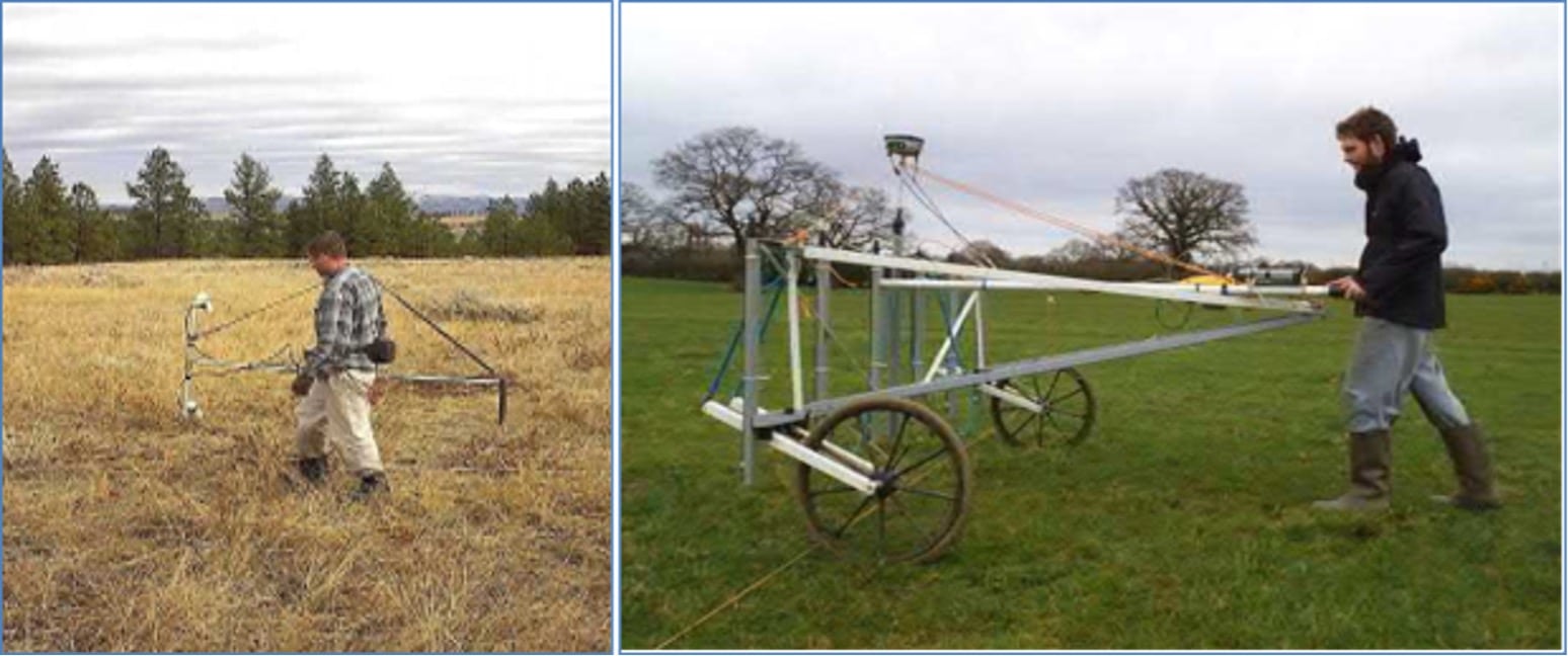
[Image of surveys being undertaken]
The team at Wessex Archaeology have worked collaboratively with our consenting partners Royal Haskoning DHV to ensure geophysical data was collected from a range of land types including sand dunes, marsh lands and arable fields. To do this they have walked as much of the onshore cable route as possible, using with survey equipment to identify any potential archaeological interests that may require further investigation. They’ve tackled challenges including the successful manoeuvre of large pieces of kit in and out of several tricky locations, as well as navigating surveys to avoid interactions with livestock in fields. Congratulations to the whole team!
This is a huge milestone for the project and all the necessary data for consent (including the marine mammal and bird surveys commenced that were completed in 2020) has been collected.
Although some studies demand long data collection periods, most require a shorter duration. This means that most of the survey work has undertaken this year, resulting in a flurry of activity, especially over the summer months. The below table shows when and for how long each of the onshore environmental surveys were undertaken.
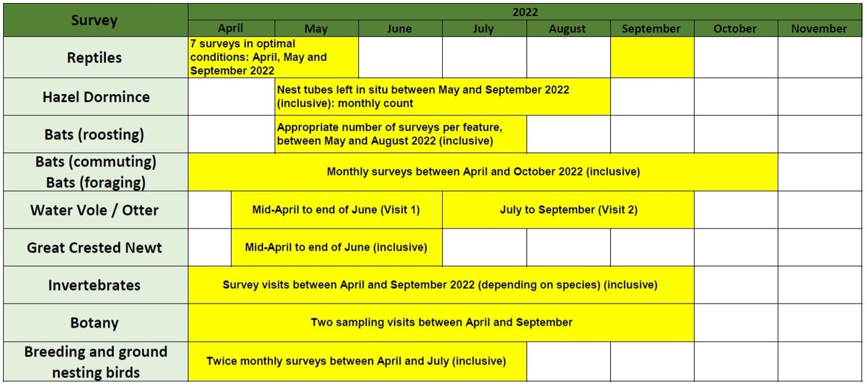
[Image of survey scheduler]
In addition to these, offshore geophysical and benthic surveys were completed over the summer – read our previous blog for more information Geophysical Survey Completion – White Cross Offshore Wind.
All the data will now be analysed and reviewed to provide a detailed picture of the environmental and geophysical features of the project area. The results will inform the project design, the environmental impact assessment process and support the consent application.